Trupulse 360B Laser Rangefinder
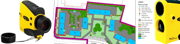
Our field surveyors currently use the Trupulse 360B Laser Rangerfinder. The integrated Bluetooth removes the need for USB connections and makes it much more practical and user friendly in the field. Tree Wise Mobile allows users to plot any number of trees from one position, within at least a 30 metre range.
The TruPulse 360 combines a compass, laser rangefinder and inclinometer in one unit. It combines the latest electronic compass technology that allows the instrument to take an accurate azimuth reading no matter how it is orientated. The laser can be tilted, rolled or used upside down, and it will still measure the correct azimuth in the direction that the user is viewing, allowing ultimate freedom.
The TruVector compass technology allows a simple field calibration procedure. It evaluates the local magnetic environment and provides user feedback on the quality of calibration. It even tells you when it needs to be calibrated.
The Missing Line Routine calculates distances and angles and is a simple 2-shot routine that instantly calculates the distance, inclination and azimuth direction value between any two remote point. It is ideal for calculating span lengths such as crown spread and tree height.
Data communication is via either a wired RS232 serial (standard) or is wireless with the Bluetooth® option, TruPulse 360B. The unit is supplied with protective case.
For more information or details of pricing please contact us.